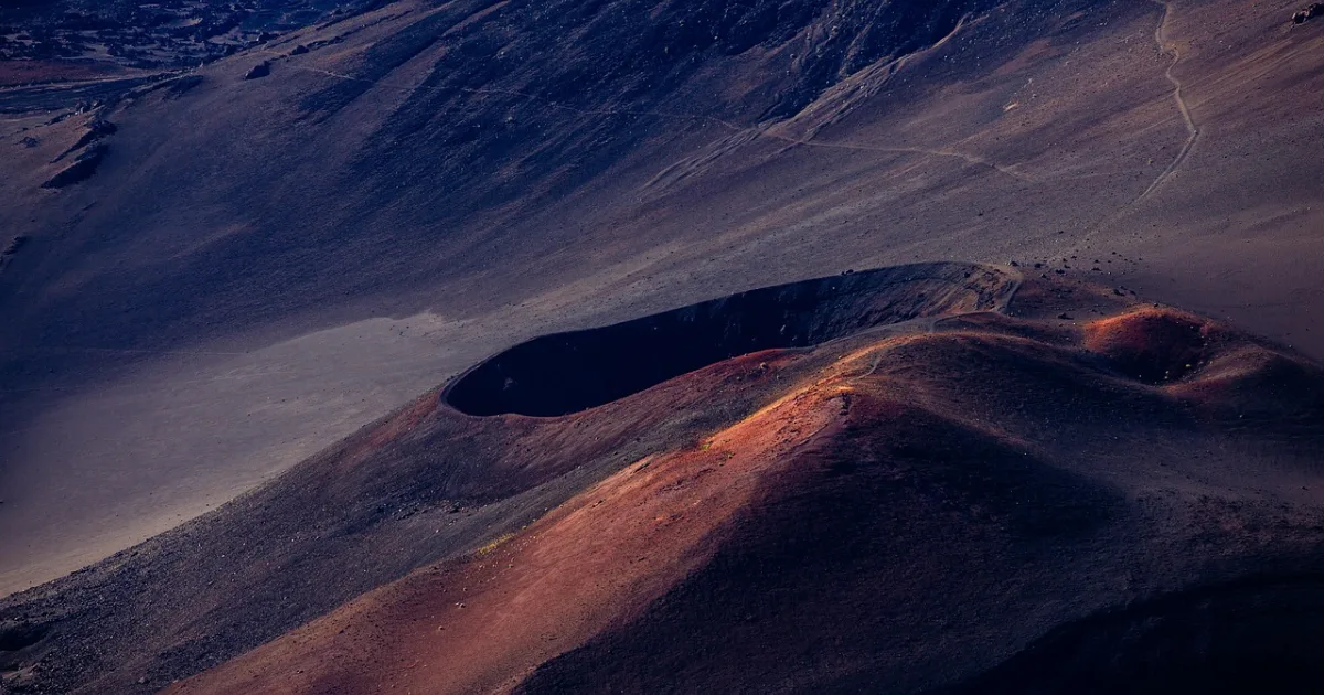
Volcanic ash emitted by an active volcano in Colombia has become the subject of international aviation monitoring.
On November 14, 2026, the Federal Aviation Administration's Air Traffic Control System Command Center (ATCSCC) issued a volcanic activity bulletin concerning Puracé volcano in Colombia.
The bulletin was identified as ATCSCC Advisory 040.
It contained information from Volcanic Ash Advisory 2026/722, issued by the Washington Volcanic Ash Advisory Center (VAAC).
The central finding was that the volcanic ash had been assessed as dissipated.
The advisory indicated that no additional volcanic ash clouds were expected at the subsequent 6-, 12-, and 18-hour forecast intervals.
However, the bulletin contained an important qualification.
Weather clouds were obscuring much of the satellite view, making it difficult to identify volcanic ash clearly.
Ground-based webcams showed no obvious volcanic activity, and no new ash reports had been received for more than four hours.
Considering these observations together, aviation authorities assessed that the immediate volcanic ash hazard had diminished.
But the absence of observable ash does not mean that volcanic activity itself has ended.
Only a few hours earlier, a new ash emission had been reported.
Colombia's geological authorities had also indicated that unstable volcanic conditions continued at Puracé.
The bulletin illustrates a fundamental principle of aviation safety.
The fact that a hazard is not currently observed is not the same as a guarantee that the hazard will not recur.
1. What Happened at Puracé Volcano?
Puracé is an active volcano located in the Cauca Department of southwestern Colombia.
It belongs to the Los Coconucos volcanic complex, which contains several volcanic structures.
According to the volcanic information used by the Washington VAAC, Puracé's summit elevation is 15,256 feet, or approximately 4,650 meters above sea level.
For aviation safety, however, the summit elevation is not the only important measurement.
The altitude reached by volcanic ash is equally significant.
Volcanic Ash Advisory 2026/721, issued at 01:13 UTC on November 14, reported a new ash emission.
The advisory estimated that ash emitted at approximately 00:40 UTC was moving westward from the vicinity of the volcano.
The estimated affected altitude extended from the surface to flight level FL180, or approximately 18,000 feet above sea level.
That corresponds to roughly 5,500 meters.
Because the volcano's summit already stands at approximately 4,650 meters, this figure should not be interpreted as meaning the ash rose 5,500 meters above the summit.
Advisory 721 estimated that the ash was moving westward at approximately 10 knots.
However, the volcanic ash cloud had not been directly identified in satellite imagery.
Weather clouds obscured the summit area.
Instead, the advisory combined information from a Volcano Observatory Notice for Aviation (VONA) with meteorological forecast models to estimate the ash's likely location and movement.
This illustrates how aviation volcanic ash advisories combine direct observations, indirect reports, and predictive modeling.
2. The Risk Assessment Changed About Six Hours Later
The situation was reassessed later that morning.
At 07:08 UTC on November 14, the Washington VAAC issued Volcanic Ash Advisory 2026/722.
In South Korea, the corresponding time was 4:08 p.m. on November 14.
The FAA subsequently distributed the information through its air traffic advisory system at 07:10 UTC, or 4:10 p.m. Korea Standard Time.
Advisory 722 assessed the volcanic ash as dissipated.
No ash was identified in satellite observations, and no clear activity was visible through the webcam.
No new ash reports had been received for more than four hours.
The forecast also changed.
The advisory indicated that no volcanic ash clouds were expected at the forecast times of 12:30 UTC and 18:30 UTC on November 14 or 00:30 UTC on November 15.
These correspond to 9:30 p.m. on November 14, and 3:30 a.m. and 9:30 a.m. on November 15 in South Korea.
The updated assessment supported the conclusion that the immediate aviation hazard from volcanic ash had decreased.
However, the conclusion was based on observations and forecasts available at a particular point in time.
If another ash emission occurred, the situation could change again.
3. Why Must Authorities Continue Monitoring When Satellites Cannot See Ash?
One of the most important statements in the advisory concerned the absence of identifiable volcanic ash in satellite imagery.
At first glance, this might suggest that the ash had completely disappeared.
But observational information requires more careful interpretation.
The Washington VAAC explicitly stated that meteorological clouds obscured most of the satellite view.
Satellites used to monitor volcanic ash employ imagery from multiple wavelengths.
However, weather conditions can make it difficult to distinguish volcanic ash from surrounding atmospheric features.
When thick clouds conceal the summit or the expected ash transport path, the ability to assess ongoing volcanic activity may be limited.
Consequently, saying that ash was not identified in satellite imagery does not necessarily mean that the absence of ash was directly confirmed.
The observation must be considered alongside other information.
In this case, webcams showed no obvious activity, and no additional ash reports had been received for a period of time.
Taken together, those observations supported the assessment that the earlier ash cloud had dissipated.
This demonstrates how uncertainty is managed in natural hazard monitoring.
Declaring that no risk exists simply because a hazard was not observed is different from explaining observational limitations while assessing the likelihood of an existing hazard.
For aviation safety, that distinction is particularly important.
4. How Are Colombian Authorities Assessing the Volcano?
Puracé's activity did not begin or end with the events of November 14.
According to Colombia's Geological Survey, Servicio Geológico Colombiano (SGC), unstable volcanic activity continued at Puracé and the surrounding Los Coconucos volcanic complex between November 3 and November 9, 2026.
During that period, authorities recorded 17 volcanic ash emissions.
Some ash columns rose approximately 1.3 kilometers above the summit.
Volcanic gas emissions also continued.
The geological agency reported significant sulfur dioxide and carbon dioxide emissions, along with thermal anomalies in certain areas.
Seismic activity associated with fluid movement inside the volcano and rock fracturing was also monitored.
These indicators help scientists understand changes within the volcanic system.
Colombian authorities maintained Puracé's volcanic activity alert level at Yellow in early November.
Yellow indicates that the volcano is showing changes from its normal or baseline activity.
It does not, however, constitute a definitive prediction of an imminent major eruption.
The important point is that unstable volcanic conditions mean the possibility of renewed ash emissions cannot be ruled out.
The disappearance of one ash cloud therefore does not end geological monitoring.
5. Why Is the U.S. FAA Issuing Information About a Volcano in Colombia?
The bulletin may raise an obvious question.
If the volcano is located in Colombia, why is the U.S. Federal Aviation Administration distributing information about it?
The answer lies in the international structure of aviation.
Aircraft travel across national borders.
Volcanic ash can also move across borders as winds carry it through the atmosphere.
Information needed to protect aircraft from volcanic ash hazards is therefore not limited to the country where an eruption occurs.
Within international aviation, regional Volcanic Ash Advisory Centers monitor the location and movement of ash and provide specialized information.
The Washington VAAC is one of these centers.
In this case, the Washington VAAC issued information about Puracé, and the FAA's ATCSCC distributed it to aviation stakeholders.
This does not mean that the FAA directly controls all air traffic operating in Colombian airspace.
VAAC advisories provide specialized hazard information used by airlines, pilots, and air traffic authorities in flight safety decisions.
Actual flight operations, route changes, and airport management decisions are made by the relevant aviation authorities and operators using available information.
The November 14 bulletin was not itself an order closing a particular airport or grounding all flights.
FAA volcanic activity advisories must be distinguished from actual flight restrictions.
6. Why Is Volcanic Ash Dangerous to Aircraft?
Volcanic ash is different from ordinary dust or smoke.
It can contain finely fragmented rock, minerals, and glass-like particles.
If these particles enter a jet engine, they can create serious problems.
At the high temperatures inside an engine, some volcanic ash particles may melt and subsequently solidify, interfering with engine components and airflow.
This can reduce engine performance and, in severe cases, cause an engine to stop functioning.
Volcanic ash particles can also abrade an aircraft's exterior surfaces and cockpit windows and interfere with various sensors.
Another challenge is that ordinary weather radar and air traffic radar are not designed to detect volcanic ash reliably under all conditions.
Pilots may find it difficult to distinguish an ash cloud from an ordinary meteorological cloud by sight.
The danger becomes greater at night or when cloud cover is extensive.
The FAA emphasizes that aircraft should avoid volcanic ash clouds whenever possible.
Air traffic controllers are also expected to provide pilots with available information about ash-cloud locations and altitudes and, when appropriate, suggest alternative routes around affected areas.
These procedures make continuous monitoring of ash emissions and movement essential.
7. Does “Ash Dissipated” Mean Flights Have Resumed?
The latest advisory assessed the ash as dissipated and forecast no additional ash clouds at the specified future intervals.
However, that should not be interpreted as an announcement that particular flights had resumed.
The FAA bulletin did not provide specific information about airport closures, flight cancellations, or the resumption of operations.
It is therefore not possible to determine from the bulletin alone whether any airport closed, how many flights were canceled, or how many aircraft were rerouted.
Even when a VAAC advisory reports that an ash cloud has dissipated, airlines must continue monitoring the possibility of renewed emissions and updated meteorological information.
Once released, ash can create hazards as it moves away from the volcano.
A new emission can also change previously issued forecasts.
To confirm the operational status of a particular flight, the latest information from the airline, airport, and relevant air traffic authority must be consulted separately.
8. Why Do Volcanic Ash Forecasts Refer to 6, 12, and 18 Hours?
The bulletin included three forecast intervals.
Six hours.
Twelve hours.
Eighteen hours.
These intervals reflect the need to assess not only the current state of volcanic ash but also its likely location and movement over time.
The danger from ash does not exist only at the moment of emission.
Once released, volcanic ash can travel with prevailing winds.
Over time, it may affect locations far from the volcano where the activity originated.
For flight operations, the crucial question is therefore not simply where ash is now.
It is where ash is likely to be when an aircraft passes through a particular area.
That is why volcanic ash advisories include information about expected movement direction, speed, altitude, and future location.
In the Puracé case, Advisory 721 described a new ash emission and its potential movement.
Advisory 722 subsequently assessed that no ash clouds were expected at the later forecast times.
The two advisories are not contradictory.
They represent updated risk assessments based on additional observations and reports.
Aviation safety systems manage hazards through precisely this process of continuous information updates.
9. Why Must Volcanic Ash Advisories Disclose Uncertainty?
Accurate numerical information is important in volcanic ash monitoring.
But so is understanding how confidently that information is known.
Direct observations should be distinguished from estimates.
For example, a situation in which an ash cloud is clearly visible in satellite imagery differs from one in which weather clouds prevent direct observation and the likely presence of ash must be inferred from other reports.
Aviation authorities identify such distinctions in their advisories.
Both Puracé advisories, 721 and 722, described limitations affecting satellite observations.
These qualifications are not intended to undermine confidence in the information.
They are intended to communicate its limitations to the people making operational decisions.
Airlines, pilots, and air traffic organizations may use the same information differently depending on the certainty of the observations.
Underestimating a hazard can create serious safety risks.
Conversely, treating every uncertain possibility as a confirmed hazard can lead to unnecessary operational restrictions.
Effective risk management therefore requires consideration of observations, forecasts, and uncertainty together.
The Puracé advisories demonstrate how this complex assessment process can be condensed into a relatively brief aviation bulletin.
10. What Would Indicate That Volcanic Activity Is Stabilizing?
The absence of a visible ash cloud does not establish that activity inside a volcano has stabilized.
Volcanic conditions are assessed through multiple indicators.
These include seismic activity, ground deformation, volcanic gases, thermal anomalies, eruptions, and ash emissions.
Colombia's Geological Survey continues monitoring these indicators at Puracé.
On September 29, the volcanic activity alert level was adjusted to Yellow as activity decreased.
However, official reports in early November continued to describe unstable conditions.
Assessing whether the volcano is returning to a stable state will therefore require examining changes across several indicators, not simply counting ash emissions.
The continued Yellow alert also does not mean every surrounding area faces the same level of danger.
Volcanic hazards can vary depending on distance, terrain, wind direction, and the characteristics of volcanic activity.
Residents and visitors should consult the latest volcanic activity reports and local safety or access guidance issued by Colombian authorities.
In aviation, the latest VAAC advisories and operational notices remain important.
The Greater Challenge Is Not the Ash That Disappeared, but the Next Hazard That Must Not Be Missed
The FAA's November 14, 2026, bulletin concerning Puracé was relatively brief.
It reported that volcanic ash had been assessed as dissipated several hours after a new emission was identified.
No additional ash clouds were forecast through the subsequent 18-hour outlook.
That was positive information for aviation safety at the time.
But the significance of the bulletin was more complex.
Satellite monitoring faced weather-related limitations.
Ground observations, additional reports, and forecasts had to be considered together.
Colombia's Geological Survey continued to assess Puracé's activity as unstable.
The advisory should therefore not be interpreted as a declaration that the volcano had completely stabilized.
In international aviation, volcanic ash information is updated as hazards develop.
Even when a risk is assessed as reduced at one moment, renewed volcanic activity can require a fresh evaluation.
The essential question is not simply whether the volcano erupted or whether an ash cloud disappeared.
It is which hazards have been identified, what information remains uncertain, and how those hazards might change.
The Puracé advisory illustrates that aviation safety does not depend on the complete disappearance of danger. It depends on a system that continuously observes changing hazards, forecasts their movement, and adjusts flight operations accordingly.
The ash was assessed as dissipated during the latest observation period.
But monitoring of the volcano has not ended.
For aviation safety, the more important question is how quickly and accurately authorities can detect and communicate the next ash cloud if another emission occurs.